by Mike Freedberg
SPECIAL TO EASTBOSTON.COM
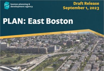
(EAST BOSTON) – The Boston Planning and Development Agency – casually known as “the BPDA” – earlier this month released its long-awaited “East Boston – Full Draft” plan, asking for public comment.
One wants to laugh at that. Does “the BPDA” really want to hear the tidal wave of comment, all of it opposed, that has washed up against “The Plan?”
I’ll get to that wave of opposition later. First comes the plan itself. It is a two-part plan: housing plans and traffic and parking proposals. (The two parts are sequenced together.) My report addresses only the housing part of these plans, at least partly because the traffic and parking plans require state government’s input, and that’s an entirely other process.
The housing plan sees East Boston as six separate, different neighborhoods: Jeffries Point and Gove Street; Maverick Central; Eagle Hill and Paris Flats; Harbor View; Orient Heights: and Belle Isle Peninsula. This division makes sense. The six segments really are different in turf, street pattern, architecture, and waterside.

They are also different ethically: East Boston’s Hispanic majority – 56 percent of the neighborhood – is largely (though not exclusively) concentrated in Eagle Hill – Paris Flats and Maverick Central; gentrification is the hallmark of Jeffries Point, with a South American (much of it Peruvian) community in Gove Street. Harborview is home to families of Italian and Irish descent as well as some of Quebecois origin. Orient Heights is East Boston’s Italian-heritage core neighborhood. Belle Isle peninsula is even more traditionally Irish and Italian, but more middle class than Orient heights, which is home to much of Eastie’s elite. (Note: East Boston is also home to a significant Moroccan and Algerian diaspora, but they live pretty much in every part of the neighborhood rather than concentrated.)
If the plan smartly identifies East Boston’s component communities, however, it treats them with hardly any residential respect. And here is where the universal opposition to the “plan” arises.
Each neighborhood has its own “recommendation for Land Use and built form.” Let’s look at three of them, as examples of what the plan envisions doing.
The Belle Isle Peninsula plan (some technical terms are contained in it, I shall unpack them after I give you the plan’s relevant language) says this:
“Today most of the area is contained within a singler 2F-4000 subdistrict, with a small portion of 3F zoning along Barnes Avenue…Rebalance the geography of the two subdistricts to account for the existing building forms, land uses, and distance to the Orient Heights Blue Line station.
“A subdistrict allowing for new buildings to be three stories and up to three units on most lots and six un its larger lots could be created northwest of St Edward Road (within a quarter mile walking distance of the station). Southeast of St Edward Road (further from the T), new buildings would be allowed to go up to 2 ½ stories and up to two units, similar to what is allowed today.”
There’s a lot more to unpack here than a casual reading tells us. First, why is the T referred to in a housing recommendation, when transportation is the theme of the other, traffic and parking plan? It’s because one of the major housing objectives of this plan is to build “transit-oriented” dwellings, i.e., units that are near enough to a T stop to allow buildings that don’t include parking for cars – i.e., that anticipate being lived in by people who don’t own cars. And the non-ownership of cars by people living here is a major objective of the city’s climate change agenda.
Second, why does the Belle Isle plan authorize “new buildings”? Belle Isle Peninsula – better known in East Boston as “Bayswater” — is already fully built up, a suburban-looking neighborhood of single family and two-family homes, with lawns and driveways, most of it built in the 1920s. I doubt there are six buildable, unimproved lots in the entirety of it. The section has a character distinct enough to have impacted the “Plan” description which I quoted: by changing it with “new buildings”? Where would you even put them?
I am loath to answer that question.
Let me now turn to the plan for Harbor View – the area residents know as St Mary’s or Salesians, between Wood Island T station and Westbrook Street, including Constitution Beach and the Byron Street-Wordsworth Street hill. The “plan” has much to say about how Harbor View should zone:
“Connect the Day square Neighborhood Shopping subdistrict to the Orient Heights Neighborhood Shopping subdistrict along Bennington Street.
“To enhance Bennington’s role as a major connective corridor, both sides of the street will be added to a newly created subdistrict allowing up to four residential stories…”
You read it right: the Plan wants to intensify Bennington Street, not calm it. I haven’t polled them all, but most residents of Bennington Street I talk to want the street to not be a “corridor’ between day Square and Orient Heights. Cars speed excessively, as it is, along Harbor View’s portion of Bennington; accidents occur with fair frequency. Why would a plan which anticipates a lot of no-cars new buildings want to boost Bennington’s drag strip identity?
Nor is the Day Square connection a smart reach. Day Square is separated from Harbor View by a long strip of unusable land beneath the McClellan Highway overpass, which crosses Bennington Street at an almost parallel angle. Try walking from the 120 Bus Stop in Day Square to the Wood Island T station.
It’s no mean jaunt, and it is empty of buildings and will be thus empty as long as the overpass remains.
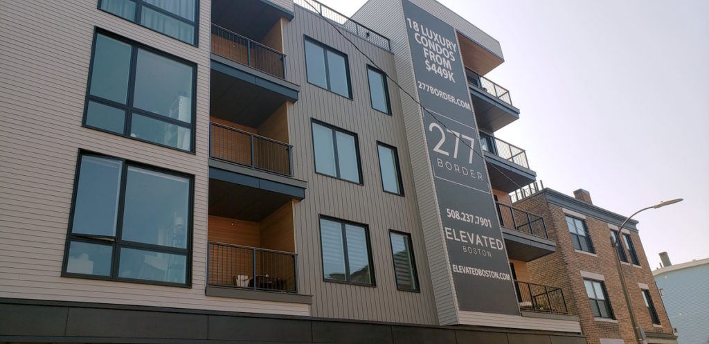
Lastly, I don’t think there’s many folks living in Harbor View’s Bennington Street segment who would love to see a ton of four-story block-cut “luxury condos” – which is what you’ll continue to get – going up every fourth or fifth lot, replacing homes torn down because they have no profit in them and aren’t “dense” enough for the purpose of transit orientation.
The “plan” doesn’t only seek to connect Day Square to Orient Heights via the Bennington “Corridor.” It demands the same kind of “Bennington corridor” connection between Day Square and “Maverick Central” – Central and Maverick Squares, for which zone the “plan” is not shy –
“Connect the Central Square Community Commercial … Subdistrict to the Day Square Neighborhood Shopping…Subdistrict along Bennington Street.
“Bennington Street passes through a small Multifamily Residential / Local Shopping subdistrict centered on the Brooks Street intersection.
“Combine relevant 2F-2000 and 3F-2000 Subdistricts. …New dimensional regulations will allow for the diversity of housing types that exist.”
(Note: a 2F-2000 zone is one in which two units are allowed on a lot 2000-square-foot in size. Likewise, a 3F-2000 zone is one which permits three units on a 2000-foot lot and so forth.)
Reading the plan for the “Bennington corridor,” one easily understands that diversity of housing types, connection of shopping subdistricts, and a center at the intersection of Brooks and Bennington promotes commercial and traffic uses of the entire “connector: to the likely detriment of the many, many low-height residences that are abutters. The Day Square to Central Square Bennington “corridor” is a very residential stretch. (Personal note: it’s where my maternal grandparents lived when they immigrated to East Boston in 1896.)
Commercially, it is hyper-local: very small shops pepper the entire route; nor are the restaurants along it any larger. Yes, Bennington Street here is super busy day and night : but it is busy with its residents chiefly. Only the Kelley Square Pub, at the corner of Marion Street, attracts patrons from all over. If there is to be any change in this part of Bennington – heart of what the plan calls the “Paris Flats” – it should be to strengthen the localism of it, not run a corridor through it.
In general, as one treads the entire housing portion of the plan, one finds everywhere that it accommodates, even invites, new building. This despite that almost every resident I hear from, or read comments by, feels that East Boston has already taken in far more new dwelling developments than it can absorb. One wonders, when reading the “plan,” if it is more a look back than a look ahead, an attempt to retroactively accept the vast series of zoning variances that alone have allowed so much development to get built. It’s hardly news to any East Boston resident that, since 2014, when Mayor Walsh took office announcing his intention to build 53,000 units of housing (later upped to 69,000), the City’s Zoning Board of appeal has approved almost every development requiring variances – exemptions from the State’s zoning laws, granted supposedly only for “hardship” reasons — and that a heavy proportion of these variance grants have been given to East Boston projects.
Bremen Street, Maverick Street, the Harbor View side streets, Saratoga and Bennington Streets, Curtis and Walley Streets, Waldemar Avenue, Crestview Ave, Border Street, Murray Court, Marginal and Addison Streets – to cite just the most flagrant locations – have seen four and even five story buildings arise, some of them huge in size; and more and even larger projects await.
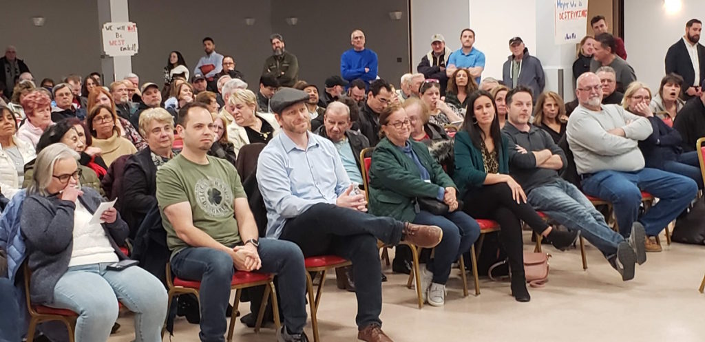
With each flurry of new developments built with multiple variances, opposition has increased. Last summer a new residents’ group, Stand Up for Eastie, founded by Joni DiMarzo, next to whose home near Wood Island a developer took over a previously grassy lot, drew well over 100 people to stand outs and similar demonstrations. At one of these, Harbor View homeowner Phil Brangiforte cried, “No more variances! Enforce the zoning laws, period!” He was lustily cheered.
This year, as the “Plan” confronted the Orient Heights neighborhood, an even larger opposition gathered. Well over 200 people – maybe 250 – assembled at the Don Orione auditorium, high atop the Orient Heights, to protest the coming of this plan, which few had yet seen but whose rumored proposals threatened the area’s single family home character.
Led by John Cass, an Orient Avenue homeowner who knows city housing plans and politics well, and who has made a thorough study of zoning laws and alterations thereof, the reconstituted Orient Heights Neighborhood Council drew enough members to force the City to meet with it in person rather than through the prophylactic of zoom. That meeting satisfied few. The city offered compromise – it would limit zoning change in Orient Heights to two-family units and to only 3000 feet of floor space – but folks tended not to believe the City’s bona fides. As Senator Lydia Edwards said at that meeting earlier this year, “There’s not a whole lot of trust here.” And just this week, Cass posted on Facebook, that in his view, even if the city keeps its word, the state may still insist on forcing ADUs (added dwelling unit) into the Orient Heights area’s zoning designation.
That’s an issue for later. The “Plan” now enters the statutory public comment period, one that is likely to extend well beyond the usual thirty days and which will probably include in-person public meetings with residents of each of the six neighborhoods focused in the plan.
The city evidently gets it now, that the Plan has united East Boston against it, and that the neighborhood will likely fight the Plan at every step of the way, especially now that opposition includes East Boston’s most high-income neighborhood, and that in that neighborhood, opposition is fiercest.
Ultimately, this fight is first of all about money, as political fights usually are: here, the rental and sale price money that developers can almost taste, the money that developers donate to found City political campaigns; the money that East Boston residents do not have to pay ever higher rents or house sale prices; the money that the city will have to spend to build the water and utilities infrastructure required by large development; and so forth. But it is also about character and community connection.
East Boston has been an immigrant and working-class community for well over 170 years. During most of that stretch it has housed immigrants in low-lying, one- and two- family houses, chiefly of wood, and in the flat-roof threes typical of most of Boston. East Boston has never had the large tenement buildings, of 10 to 50 units, that one sees in much of New York City and whose largeness dominates its residents, as East Boston’s small dwellings do not. Here, residents and residences seem to befriend one another; and the smallness of the dwellings has meant that people make friends with people on many different streets and meet in parks and on sports fields, in church and in the YMCA or the Library. In short, a community largely urban but with a feel sometimes suburban. Little wonder that East Bostonians of every political persuasion want to keep it and to not see it transformed by vast, cheaply made, high-priced buildings that look institutional and feel like Downtown offices.
East Boston sits across the harbor from the bulk of Boston. It contributes a small percentage of the City’s vote on election day.
During traffic time it is hard to get to. Before Sumner Tunnel and McClellan Highway were built during the Great Depression, East Boston was even more cut off, accessible only by ferry and the Maverick Street railway tunnel. When the Lynn, Revere, and East Boston railroad failed in 1940, it felt even less linked. McClellan Highway and the Sumner Tunnel re-connected East Boston in both directions, but the McClellan sliced through hundreds of residences along its path from the Revere line to Porter Street. Then came the taking of Wood Island, in 1960, to expand Logan Airport, a fateful decision that demolished its beautiful park and abolished whole streets of residences.
Generations of East Bostonians have fought many forms of destruction since the 1950s, successful in part but never enough. The coming of development, these past 10 years, to a neighborhood which barely 30 years ago was neglected and under-priced, has aroused the area’s old spirit of community protest and solidarity.
Gathering the current opposition took a while. At first, the city’s proposal to plan a zoning change seemed like an extension of two prior plans, East Boston 2020 and Imagine 2030, each of which enhanced the neighborhood’s amenities. And the planners included local activists by appointing an advisory board of twenty of us, all well respected. Indeed, the current draft of PLAN: East Boston features a “what we heard from you” section where you’ll find a great deal of what was said. Moreover, the draft appears to have adopted some of what was heard and to have become more sensitive to very local details.
Yet the basic policy remained in the September 1 release: enable more development, much larger structures where possible, increase density, favor “transit-oriented” dwellings that won’t increase car usage, and allow owners to add a third, adjacent, mother-in-law type of unit to their existing one and two-family home even in areas long zoned as single-family.
And as opposition to development has ballooned during the four years since it was first proposed, its release now could not have timed worse.
The “Plan” rests on two assumptions; both flawed. Does East Boston even need more housing? Boston’s population has leveled off and even declined somewhat. Second, the biotech industry, and its financial enablers, which boosted the recent economic boom has gone flat, as medical discoveries have become fewer. Add to this neutral market (at best) the coming 10,000 units at Suffolk Downs, and a strong case can be made that East Boston is overbuilt already. As activist Mary Berninger pointed out to me there are lots of empty units and many approved developments in the pipeline. (I know of two single-family homes vacant these past two years and another recently vacant. How many more might there be? Probably quite a few.)
I would add one other curious statistic: in 1910, East Boston had 70,000 residents, almost all of them in-town from Day Square. Today, it has approximately 40,000 and is fully populated, all the way to the Revere and Winthrop lines. Why then do we need even the housing we already have, much less more housing? Planners will tell you, “It’s singles now. In 1910 it was entire families.’ But sprinkling singles into our apartments is hardly the density that planners strive for. Families bring density. They also bring community cohesion, in a way that singles usually cannot.
I don’t think the planners have thought through these paradoxes. I know it’s a pain to say this, but their best move would be to scrap this plan and start from scratch on a plan that accepts the changed housing market and works to enhance the character of our neighborhoods — not erase or slice through them.
Best of all would be to ask our residents and small business owners what we want and then assemble a plan to help us achieve it. Isn’t this why we elect city governments in the first place?
— posted September 23, 2023
Mike Freedberg is editor and publisher of the blog, Here and Sphere. He is also a political consultant. He regularly contributes original, participatory content to EastBoston.com.