Jan 18, 2024
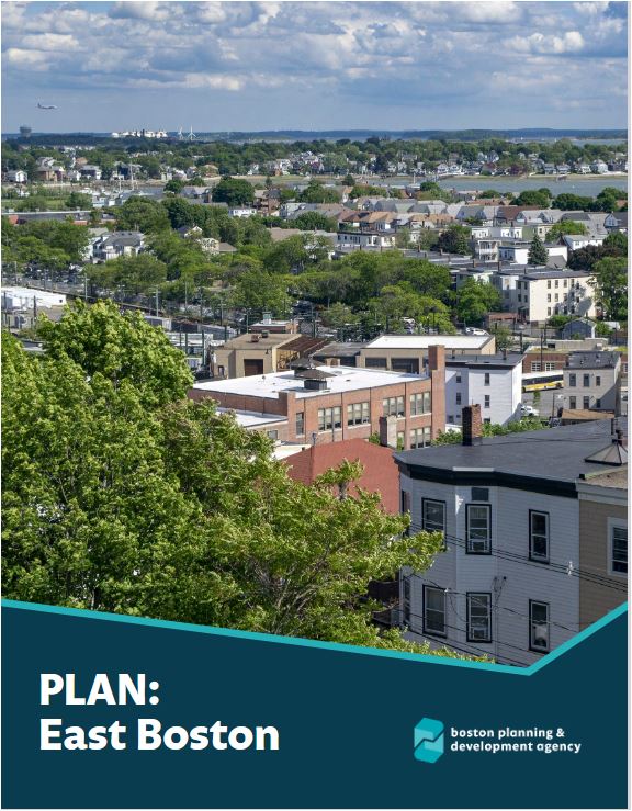
The Boston Planning & Development Agency Board of Directors today adopted East Boston Tomorrow, the PLAN: East Boston vision report, at their monthly meeting, after five years of planning work and engagement with the community. This report sets out a clear and ambitious vision for the neighborhood, deeply informed by the priorities of its residents. The plan focuses on increasing affordable housing in the neighborhood, climate change preparedness, enhanced mobility and transit options, support for local businesses, and zoning recommendations to facilitate predictable and contextual growth. These goals cover residential areas, squares and corridors, and waterfront and evolving industrial areas throughout East Boston. The board also recommended approval of updated zoning, which will now need to be adopted by the Zoning Commission.
“This document is called East Boston Tomorrow because it will truly take us into the future in the strongest way possible as Bostonians, producing a future with more housing, improved mobility, and better prepared for climate change,” said Chief of Planning Arthur Jemison. “I want to thank the community for their collaboration on this process since 2018, and agency staff for their hard work to produce a comprehensive plan that will serve East Boston for decades to come.”
Within residential areas, one of the main goals is to allow a mix of housing types while reaffirming the unique character of each area of the neighborhood. The plan recommends ensuring that the size and scale of new development in residential areas is consistent with what already exists. There is also an emphasis on improving access to neighborhood retail amenities. Neighborhood corner stores are an integral part of East Boston’s economy and social fabric, as they provide walkable access to essential goods and services. Because of this, the plan recommends updating zoning to allow for a mix of uses like coffee shops, laundromats, and community uses like daycares, all of which are prohibited by the current zoning. By rezoning the residential areas in East Boston, infill development will be allowed at a contextual and appropriate scale, thereby reducing the reliance on the Zoning Board of Appeal.
East Boston’s squares and corridors are the neighborhood’s centers for gathering, providing essential goods and services, and connections to downtown via public transit. The plan mainly recommends an increase in density in these areas as a way to expand access to housing options. This is essential as the City faces a housing crisis. By intentionally encouraging housing production in transit-accessible areas that offer an abundance of commercial, civic, and cultural resources, East Boston residents and business owners will feel benefits beyond access to housing. When daily needs are available close to home, time and money spent on transportation, and the number of car trips, can be reduced. In addition, small business owners can benefit from a larger pool of nearby patrons and employees.
East Boston’s waterfront and evolving industrial areas were originally formed with the intention of serving industry and infrastructure, but today leave much of the waterfront underutilized and disconnected from the East Boston community. For that reason, the plan recommends expanding public access to the waterfront and working with State and Federal agencies to protect the waterfront with resilient infrastructure. It also advocates for the adaptive reuse of the historic structures currently in these areas, and ensuring they are used for essential economic activity, such as office space, educational uses, community uses, and recreational facilities, much of which aren’t allowed under current zoning. While land use along much of the waterfront is currently controlled by the State, the plan recommends new underlying zoning in these areas that, in the event of State regulations being lifted, will allow for a mix of uses that support essential economic activity, and will create opportunities for employment focused development.
“This plan was initiated almost six years ago—East Boston was under siege with development proposals, and neighbors were exhausted trying to keep up with every individual proposal that popped up,” said PLAN: East Boston Advisory Group Member Tanya Hanel. “A lot of work has gone into drafting, presenting, listening, and revising this plan so that future development can align with the changes our neighborhood wants and needs. It also includes a lot of public improvements that I’m excited about—the key is making sure that this plan is carried out in such a way that East Boston remains a diverse and affordable place to live.”
East Boston is an environmental justice community, and the climate recommendations throughout the plan are intensely focused on coastal flood resilience and improving urban heat islands simultaneously. The entire neighborhood is vulnerable to coastal and inland flooding, and its squares are considered some of the worst heat islands in the City, particularly Day Square. Because of that, the plan recommends increased tree canopy and permeable surfaces in each area, wherever possible. In addition, in vulnerable residential areas, the Coastal Flood Resilience Overlay District will ensure that new development is raised to account for sea level rise. The plan also advocates for simultaneous expansion of ferry service and coastal resilient infrastructure to protect the public and private realm along the waterfront.
This final report includes significant changes that respond to much of the recent feedback the BPDA received during the 110 day comment period. The updated zoning associated with this plan will need to next be adopted by the Zoning Commission. The agency is proud to have produced a comprehensive planning document that the community helped to shape and create over the last five years. This is a generational effort to ensure growth and development in East Boston are predictable, appropriately scaled, and suit the needs of residents today, and in the years to come.


